Băile Harghita – Csonka-havas – Rákos Meadow – Mădăraș
A moderately difficult loop trail along the ridge of the Harghita Mountains, marked with a blue stripe — from the chalet at Băile Harghita, over Csonka-havas, Rákos Meadow and Nagy Meadow, up to the "sacred mountain of the Székelys", the 1801-metre Mădăraș Peak.
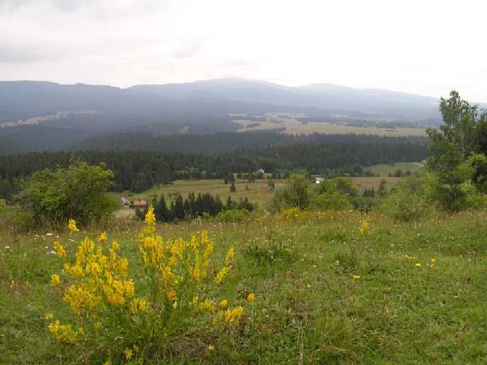
Source: Wikimedia Commons
About the trail
This is one of the finest ridge hikes in the Harghita Mountains — starting from the chalet at Băile Harghita, the route follows the blue-stripe blaze across Csonka-havas, Rákos Meadow and Nagy Meadow all the way to the Harghita chalet, and from there ascends to the Mădăraș Peak at 1801 metres.
Most of the route runs through open clearings and along ridge sections, opening up breathtaking views over the surrounding ranges: the Gurghiu Mountains, Giurgeu Mountains, Hășmaș Mountains and the Ciuc Basin, and on clear days even the Făgăraș Mountains are visible.
Although the hike is of moderate difficulty, the 4-hour duration combined with the elevation gain and high-mountain weather call for solid fitness and proper equipment. It is recommended as a summer hike — in winter, owing to the snow conditions, it is suitable only for experienced hikers.
Mădăraș Peak – the sacred mountain of the Székely Land
The trail's destination, the 1801-metre Mădăraș Peak, is the highest point of the Székely Land and of the Harghita Mountains. Often called the "sacred mountain of the Székelys", the summit is the surviving northern rim of a former volcanic caldera roughly 5 km in diameter.
From the peak a singular panorama unfolds: to the west lies the Transylvanian Basin, to the south-east the Rákos-Harghita and the Ciuc Mountains, and to the east the Ciuc Basin and the Ghimeș region. The summit is adorned with cairns, Székely grave-posts, monuments and ribbons — the relics of a place that has become a Hungarian pilgrimage site.
The Mădăraș (Harghita) chalet stands at 1650 metres, just below the peak; it was built in 1941 with the support of the Hungarian government. Fully refurbished in 2015, the chalet still welcomes hikers today.
Interactive map
The green markers indicate the 6 stages of the trail. Zoom with the scroll wheel; click for details.
Trail waypoints
Băile Harghita chalet
Starting point in Băile Harghita — the blue-stripe blaze toward the ridge begins here.
46.3842° N · 25.6425° E
Csonka-havas
First major summit along the route, a ridge-side point with a fine view.
46.3983° N · 25.6178° E
Rákos Meadow
A broad, open clearing on the ridge — panoramic views over the Ciuc Mountains and the Ghimeș region.
46.4172° N · 25.6025° E
Nagy Meadow
The second large clearing — a resting place with views to the surrounding summits.
46.4397° N · 25.5655° E
Harghita chalet (Mădăraș)
At 1650 m, built in 1941 — a place to eat and rest before the final summit push.
46.4388° N · 25.5805° E
Mădăraș Peak (1801 m)
End of the trail — the highest point of the Székely Land, marked by cairns and monuments.
46.4531° N · 25.5820° E
Tips for the hike
Take layered clothing — the summit is windy and noticeably colder. At 1800 metres the vegetation is alpine in character (dwarf pine, bilberry, juniper). If the peak itself is part of your plan, allow an extra half hour from the Harghita chalet.
Getting there from Miercurea Ciuc
From the town of Miercurea Ciuc, take national road DN13A in the direction of Odorheiu Secuiesc. Băile Harghita lies about 22 km from the county seat. In the village, the trailhead is easily found by following the signs to the Băile Harghita chalet. The asphalt road is passable by both car and bus.
Related hiking trails
Further hikes in the Miercurea Ciuc area, within the Harghita Mountains: